Rapid Vegetation Assessment
FOR ENTIRE NETWORKS
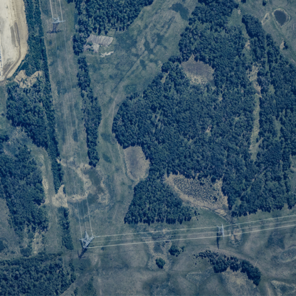
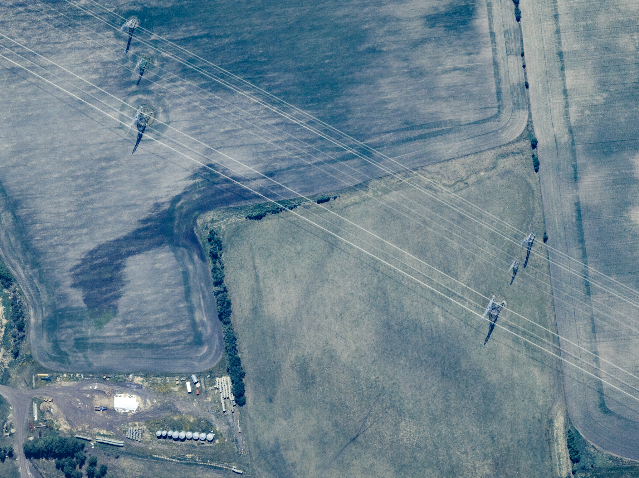
Utilizing our 10 cm aerial imagery, we provide precise locations of powerline poles, wires, and analyze surrounding vegetation. By classifying vegetation encroachment into risk levels, utilities can prioritize resources where needed, ensuring timely action to reduce hazards and improve network reliability. With our rapid, large-area coverage, we can assess entire networks efficiently, enabling comprehensive monitoring at scale.
Every Pole, Every Line, Every Time
Modelling Risk with Accurate Pole Locations
Many utilities rely on outdated asset databases, leading to inefficient risk modeling and inaccurate vegetation assessments. If you don’t know exactly where your poles are, how can you confidently assess encroachment risk?
Our advanced remote sensing solutions extract precise pole locations from high-resolution imagery, ensuring you are working with accurate, up-to-date asset data. This enables utilities to:
- Verify asset locations instead of relying on outdated or estimated records.
- Improve modeling accuracy to assess vegetation risk more effectively.
- Eliminate blind spots and ensure every part of the network is accounted for.
Utilities gain a clear, accurate foundation for risk modeling and decision-making by aligning vegetation encroachment assessments with real-world pole positions – reducing errors, avoiding unnecessary maintenance costs, and improving overall network resilience.
Save Costs Through Effective Planning
- Targeted Resource Allocation: Focus vegetation management where it matters most.
- Cost-efficient Maintenance Cycles: Reduce unnecessary trimming and inspections.
- Annual Network-wide Updates: Stay ahead of encroachment with proactive planning.
By leveraging high-resolution aerial data and advanced vegetation analytics, utilities can optimize spending, improve operational efficiency, and enhance grid reliability delivering a smarter, more effective approach to vegetation management.
Redefining Remote Sensing for Utilities
High-speed aerial data collection for precise asset management and vegetation risk assessment.
Priority-Based Vegetation Encroachment Assessment
Verify and update asset databases with accurate pole positions while modeling conductor lines to assess vegetation risk and encroachment.
Rapid Large-Area Coverage
Map entire utility networks in weeks with our high-speed Learjet, delivering faster, more efficient data collection.
Ultra-High-Resolution Aerial Data
Capture 10 cm RGB & NIR imagery and 20 cm digital surface models for precise pole mapping, vegetation analysis, and terrain modeling.
Speed, Precision, and Cost Savings in Vegetation Management
At IO Aerospace, we provide fast, scalable solutions designed to help utilities manage the challenges of vegetation interacting with their infrastructure most efficiently. With our advanced aerial data acquisition, we can cover vast network areas—spanning thousands of square miles—in just a few days. This allows for the quick identification of potential risks and the optimization of maintenance efforts.
Using ultra-high-resolution imagery and digital surface models, we deliver precise, near real-time insights into the location of assets and vegetation. This empowers utilities to proactively address conflicts, ensuring more efficient resource allocation, reducing operational costs, and preventing costly outages.
Our solutions help utilities stay ahead of vegetation-related risks, optimize vegetation management, and maintain the safety and reliability of their powerline networks.